Parks, free workouts, playgrounds, piers, mailboxes, shipping counters. No ads, no ranking games — just what's there, with its source.
ParksBelt Creek, through Neihartfree
Belt Creek — headwaters fishing
The creek runs out of the mountains right through town, an 80-mile tributary of the Missouri. Recovered from its mining century, it now holds rainbow, brown, brook and native westslope cutthroat trout plus mountain whitefish — the everyday fishing of Neihart.
✓ Montana FWP — Belt Creek drainage plan
ParksU.S. 89, Neihart → Kings Hill Passfree
Kings Hill & Belt Creek campgrounds
The Forest Service campgrounds string up U.S. 89 along Belt Creek and the pass — Aspen and Many Pines down in the canyon, and Kings Hill Campground at the top: 18 sites at about 8,000 ft, the high camp of the byway.
✓ Helena–Lewis & Clark National Forest
ParksU.S. 89, Kings Hill Passfree
Kings Hill Scenic Byway & Pass
U.S. 89 over the Little Belts is a designated National Forest Scenic Byway; Kings Hill Pass tops out at 7,393 ft between Neihart and White Sulphur Springs, with Showdown just below the summit. Sled dogs, snowmobiles and skiers share the high country in winter.
✓ Lewis & Clark National Forest · Central Montana
ParksU.S. 89, ~2.5 mi S of Neihartfree
Memorial Falls Trail (Trail 738)
A half-mile walk off U.S. 89, about 2.5 miles south of town, to two waterfalls — Lower and Upper Memorial Falls — dropping over Precambrian sandstone of the Neihart Formation, rock older than a billion years. Paved trailhead lot with restrooms; no motors; ice-climbing some winters.
✓ Visit Montana · Into the Little Belts · Wikipedia
ParksU.S. 89, Kings Hill · ~7 mi Sfree
Silver Crest Winter Recreation Area
Seven miles south, off the Kings Hill Recreation Area lot, the Silver Crest trails run 13.8 km of groomed cross-country skiing and snowshoeing — four loops, three warming huts, gently rolling. From the lot just north of Showdown, roughly 200 miles of groomed snowmobile trail branch across the Little Belts. (Dogs and snowmobiles stay off the ski loops.)
✓ Helena–Lewis & Clark National Forest · Visit Montana
ParksBelt Creek canyon, N of Monarchfree
Sluice Boxes State Park
The northernmost eight miles of the Belt Creek canyon, downstream toward Monarch — soaring cliffs, the old railroad bed as the main trail, and the remains of mines and cabins along the water. Established 1970. Creek crossings mean it walks only in low water, mid-July to September.
✓ Montana State Parks · Wikipedia
Post officesMain Street, Neihartfree
Neihart Post Office (59465)
The town's post office carries the same 59465 this edition is cut to — a working post office has stood in Neihart since 1882, when the camp took the prospector's name.
✓ USPS · Wikipedia
The culture layer§ 02
What's on the walls and in the halls — street art, landmarks, movie scenes, the museums and stages of the ledger — and the zips this one is twinned with, by decree and by geometry.
LandmarksSW of Neihart, Little Belt Mtnsfree
Big Baldy Mountain overlook
The 9,472-ft high point of the Little Belt Mountains rises southwest of town — the peak the whole camp lives under. Trails and forest roads off U.S. 89 climb toward it and the ridgelines of the Lewis & Clark National Forest.
✓ Lewis & Clark National Forest · Visit Montana
LandmarksMain Street (U.S. 89)free
Historic Main Street, Neihart
The false-front stores, cabins and the old jail strung along U.S. 89 are what's left of a camp that held 833 people in 1900. Much of the surviving townsite is documented by the Monarch–Neihart Historical Group; a walk up the highway is a walk through the silver era.
✓ mnhg.org · Western Mining History
LandmarksSouth of town, Belt Creekfree
Mountain Chief Mine & smelter site
One of the principal early producers; a smelter was built here at the Mountain Chief in 1885 to work the ore on the spot before the railway came. Ruins and tailings mark the ground.
✓ Great Falls History Museum · Wikipedia
LandmarksOff Main Street, Neihartfree
Neihart School
The Rustic-style schoolhouse, built in 1941 from logs cut on Kings Hill, is on the National Register of Historic Places. When it opened, 224 pupils enrolled — a last flush of the mining town. Kept up today by the Monarch–Neihart Historical Group.
✓ Historic Montana · mnhg.org — National Register
LandmarksHillside above Neihartfree
Queen of the Mountains Mine
The claim James L. Neihart, John O'Brien and Richard Harley located in July 1881 — the strike that made the town. The hillsides above Neihart are seamed with the fifty-plus mines that followed; roughly $16 million in silver came out between 1882 and 1929.
✓ Wikipedia · Western Mining History
LandmarksSnow Creek, above Neihartfree
Silver Dyke Mine
At its peak one of the largest silver producers in the world, and Neihart's last great boom: a 500-ton concentrating mill went up in 1922–23, the American Zinc, Lead & Smelting Company took over in 1923 and ran it to 950 tons a day by 1926, chasing lead and zinc — until the blocked-out ore ran out in 1929. Its waste is now part of the Carpenter–Snow Creek cleanup along Belt Creek.
✓ USGS MRDS · Western Mining History · EPA
LandmarksBelt Creek canyonfree
The Montana Central grade
On 15 November 1891 a spur of James J. Hill's Montana Central Railway climbed the Belt Creek canyon to Neihart and set off the real boom. The abandoned bed is now the spine of the trail through Sluice Boxes State Park, downstream.
✓ Wikipedia — Montana Central Railway
Museums, galleries & stages · from the business ledger
No arts links synced yet — run the sync.
Jumelage · twinned across the globe
The official ledgerLocal register · mnhg.org
Neihart's kindred towns
A town of forty holds no formal sister-city charter — but its true twin is Monarch, six miles down Belt Creek, forever paired with it in the Monarch–Neihart School and the Monarch–Neihart Historical Group. Beyond the canyon, kinship runs to Montana's other silver-and-gold camps — Castle, Elkhorn, Granite, Garnet — and to the great Silver Queens of the West: Aspen, Colorado, and Virginia City on Nevada's Comstock.
✓ Monarch–Neihart Historical Group
Antipode
Kerguelen (Port-aux-Français)
French Southern & Antarctic Lands
46.94°S · 69.25°E
Neihart's exact antipode falls in the empty Southern Indian Ocean. The nearest land is the Kerguelen archipelago — the "Desolation Islands" — about 180 km south: no native population, only the French station of Port-aux-Français, a few dozen scientists, glaciers and windswept fjords. A silver camp deep in the Montana snow and a sub-Antarctic rock at the end of the world, exactly opposite on the globe.
Longitude mirror
Baruun-Urt
Sükhbaatar Province, Mongolia
46.94°N · 110.75°E
Same parallel, longitude flipped across Greenwich — and the point lands on the far side of the world in the steppe of eastern Mongolia. The nearest town is Baruun-Urt, seat of Sükhbaatar aimag, out on the open grass and semi-desert of the Gobi's northern rim. Neihart's forested mountains and the Mongolian steppe hold the same latitude almost to the minute.
Equator mirror
Point Nemo (nearest: Chile)
South Pacific Ocean
46.94°S · 110.75°W
Latitude mirrored below the equator, same meridian: the point drops into the South Pacific in the emptiest water on Earth — the neighbourhood of Point Nemo, the oceanic pole of inaccessibility, farther from any land than anywhere on the planet. The nearest inhabited shore lies well over 2,000 km east, in Chile. As remote by sea as Neihart is by mountain road.
The living ledger§ 03
The zip's other residents — the animals, plants and corals you can actually meet here, with where to find them and when they show up.
BirdsBelt Creek, all yearresident
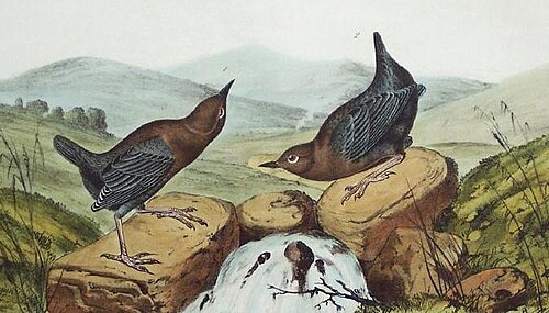
American dipper · Cinclus mexicanus
The slate-grey songbird that walks underwater — bobbing on a mid-creek rock, then diving into the current for larvae. The living emblem of Belt Creek.
✓ Montana Audubon
BirdsConifer forestresident
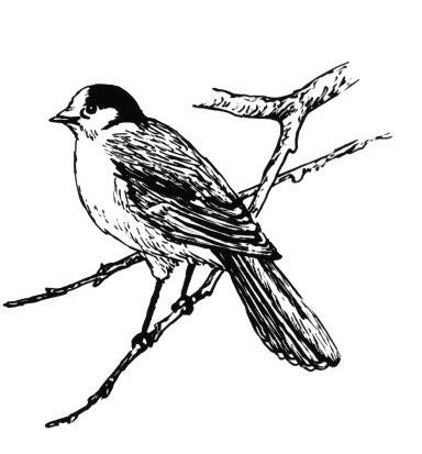
Canada jay · Perisoreus canadensis
The "camp robber" — soft grey, fearless, and certain your sandwich is partly its own, all through the Little Belt timber.
✓ Montana Audubon
BirdsHigh conifer forestresident
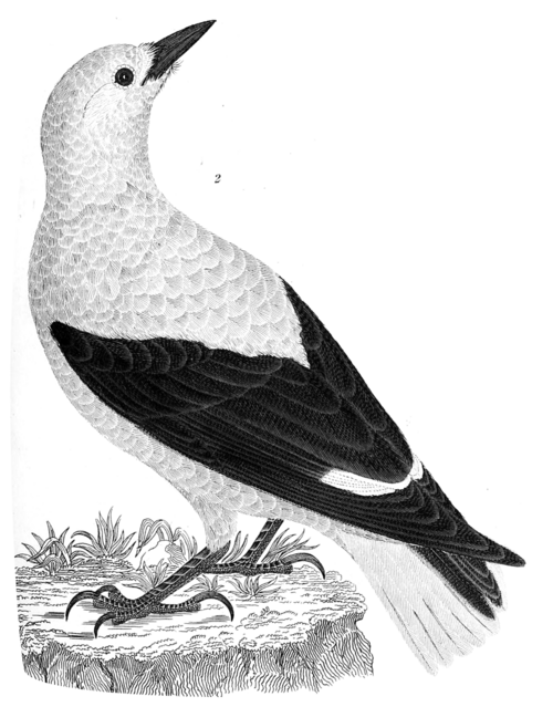
Clark's nutcracker · Nucifraga columbiana
The grey-and-black jay of the high pines, named for William Clark, caching whitebark and limber pine seeds by the thousand along the ridgelines.
✓ Lewis & Clark NF
BirdsConifer forest & edgeshooting in spring
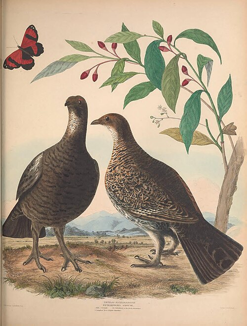
Dusky grouse · Dendragapus obscurus
The "blue grouse" of the mountain forest — it walks up into the conifers for winter instead of down, and the male's deep hoot carries through the spring timber.
✓ Montana FWP
BirdsHigh ridges & cliffsresident
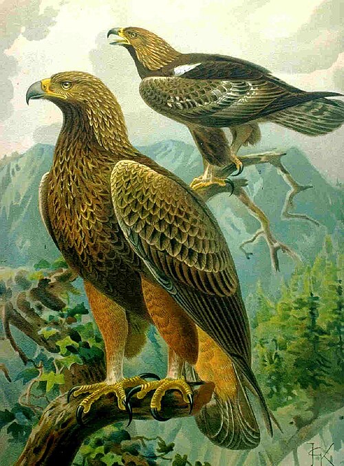
Golden eagle · Aquila chrysaetos
The great raptor of the open ridges and cliffs, riding the updrafts above Big Baldy on seven-foot wings, hunting hares and marmots in the high country.
✓ Montana FWP · Montana Audubon
BirdsMeadows & forest edgesspring–fall
Mountain bluebird · Sialia currucata
Montana's state bird — the male an impossible sky-blue — hovering over the open meadows and burn edges of the high country in summer.
✓ Montana FWP
MammalsMature conifer forestpresent
American pine marten · Martes americana
A quick russet weasel of the old spruce forest, hunting squirrels and hares through the canopy — the indicator animal of unbroken high-country timber.
✓ Helena–Lewis & Clark NF
MammalsSurrounding forestactive spring–fall
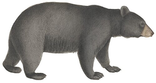
Black bear · Ursus americanus
Through the berry patches and timber of the surrounding forest; the reason the co-op sells bear spray next to the batteries.
✓ Montana FWP
MammalsBelt Creek willows & drawspresent
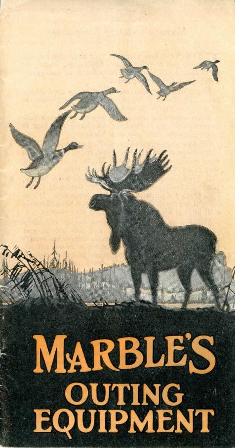
Moose · Alces alces shirasi
The Shiras moose of the northern Rockies, browsing the willows along Belt Creek and the boggy draws — big, dark and best given room.
✓ Montana FWP
MammalsHigh ridges, Little Belt Mtnspresent
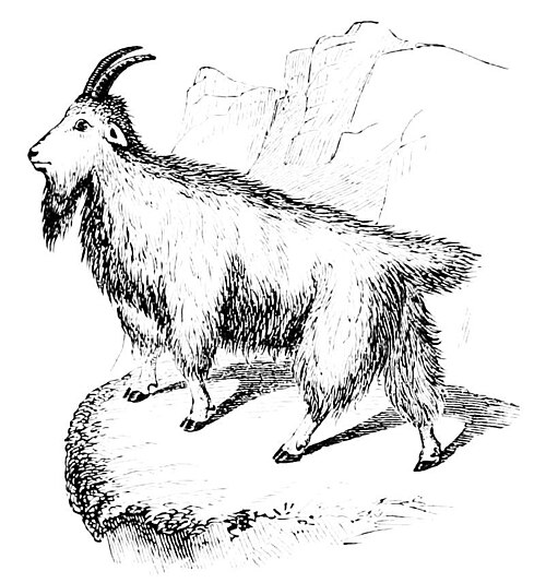
Mountain goat · Oreamnos americanus
White against the high rock of the Little Belts, on the cliffs and scree above tree line — the emblem of the range's roughest country.
✓ Montana FWP
MammalsTimbered slopes & canyonspresent · elusive
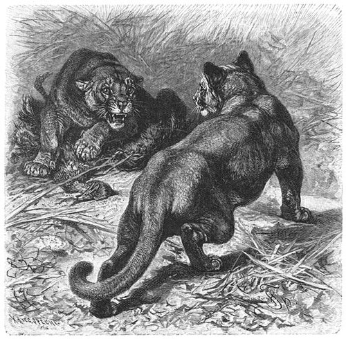
Mountain lion · Puma concolor
The big cat of the Little Belts, shadowing the deer herds through the timber — seldom seen, but the reason a track in fresh snow stops you cold.
✓ Montana FWP
MammalsSlopes above Neihartcommon
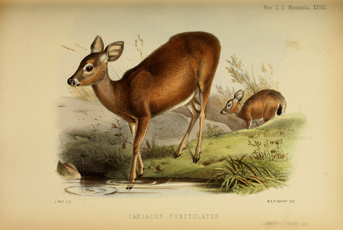
Mule deer · Odocoileus hemionus
On every hillside above the highway, big-eared and bounding; the deer you'll meet first, often right at the edge of town.
✓ Montana FWP
MammalsLewis & Clark National Forestrut in September
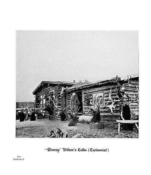
Rocky Mountain elk · Cervus canadensis nelsoni
The big game of the Little Belts, wintering in the timber and bugling on the ridges in the fall — the animal the national forest is managed around.
✓ Montana FWP · Lewis & Clark NF
MammalsLodgepole & spruce forestwhite coat in winter
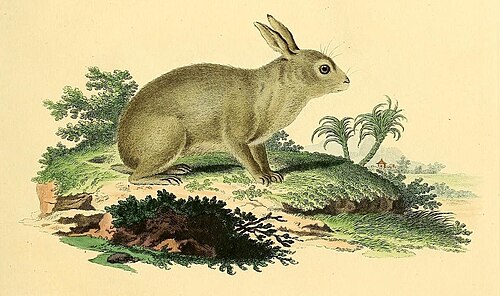
Snowshoe hare · Lepus americanus
Brown in summer, white in winter, on huge padded feet — the small life of the lodgepole understory, and the lynx's and the marten's supper.
✓ Lewis & Clark NF
Marine lifeHigh tributariesintroduced · abundant
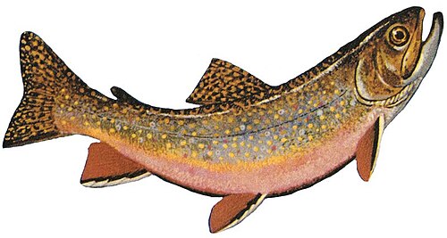
Brook trout · Salvelinus fontinalis
An introduced char that dominates the smaller, higher, colder creeks of the Little Belts — the fish of the tightest blue lines on the map.
✓ Montana FWP
Marine lifeBelt Creek, lower reachesintroduced
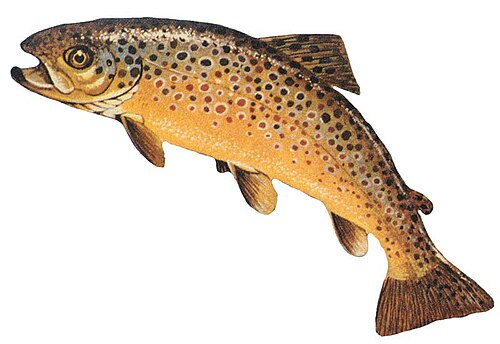
Brown trout · Salmo trutta
Fewer than the rainbows and warier, holding the deeper, slower water of the lower creek.
✓ Montana FWP
Marine lifeBelt Creeknative
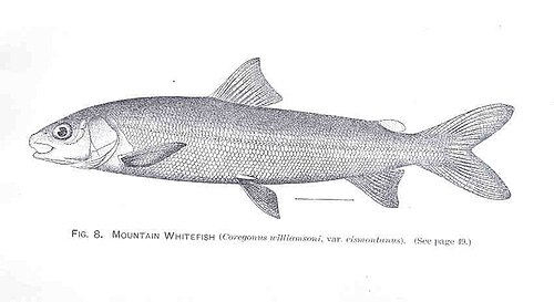
Mountain whitefish · Prosopium williamsoni
A native of the drainage, schooling in the riffles — proof the creek has healed from its mining century.
✓ Montana FWP
Marine lifeBelt Creek, lower reachescommon
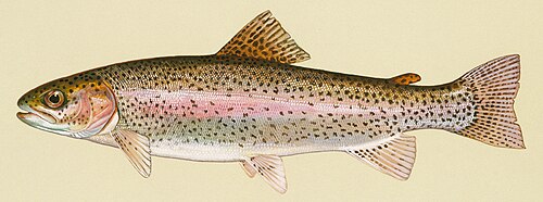
Rainbow trout · Oncorhynchus mykiss
The predominant sport fish through the lower reaches of Belt Creek — the everyday catch off the pools that run past town.
✓ Montana FWP — Belt Creek drainage
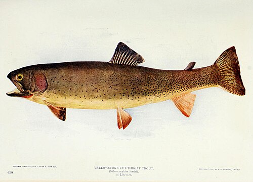
Marine lifeBelt Creek headwatersnative · sensitive
Montana's state fish and the native trout of these waters — uncommon in the mainstem now, but holding on in the cold headwater tributaries above town.
✓ Montana FWP
PlantsSouth-facing slopesblooms May–July
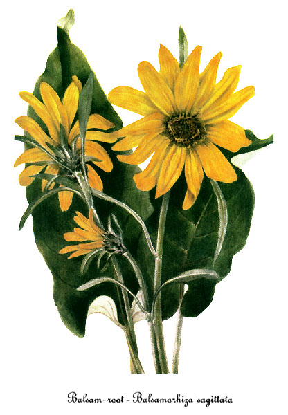
Arrowleaf balsamroot · Balsamorhiza sagittata
The big yellow sunflower-of-the-hills that sheets the south-facing slopes in early summer above the highway.
✓ Lewis & Clark NF
PlantsOpen high slopes & meadowsirregular bloom in July
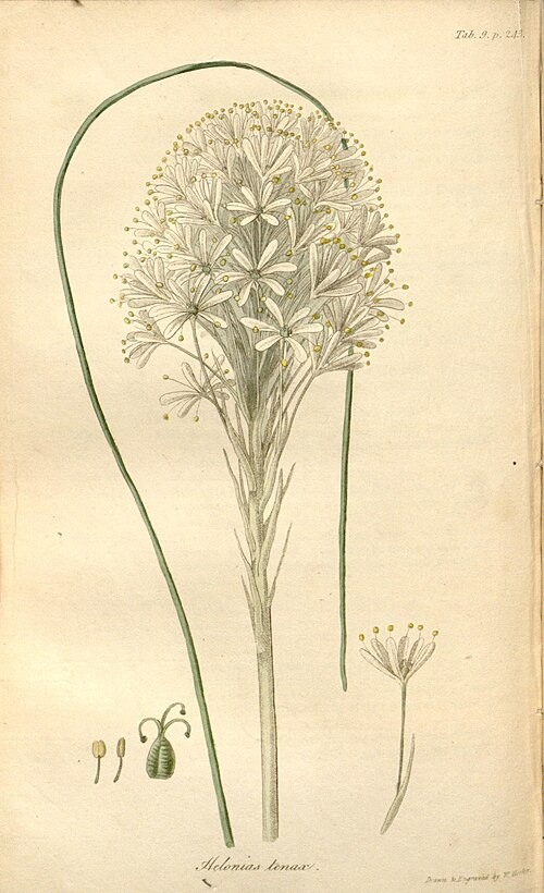
Beargrass · Xerophyllum tenax
Not a grass but a lily — a tall creamy plume over a tussock of wiry leaves, blooming in great years across the high slopes, then skipping seasons at a time.
✓ Helena–Lewis & Clark NF
PlantsDry, rocky openingsblooms May–June
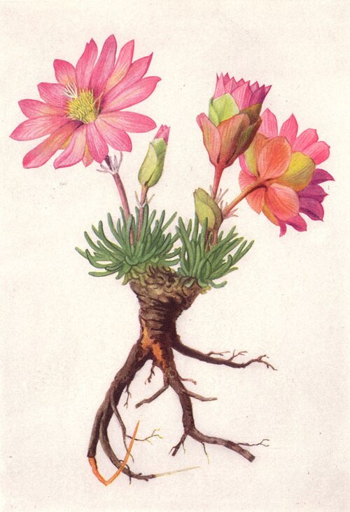
Bitterroot · Lewisia rediviva
Montana's state flower — a low rosette that throws a startling pink bloom on dry, stony ground, its root a food of the Salish and Blackfeet.
✓ Montana Natural Heritage Program
PlantsMountain meadowsblooms June–August
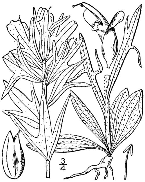
Indian paintbrush · Castilleja spp.
The scarlet "brush dipped in paint" of the mountain meadows — its color comes from bracts, not petals, and it half-feeds off the roots of its neighbors.
✓ Montana Natural Heritage Program
PlantsMeadows & roadsidesblooms June–July
Silky lupine · Lupinus sericeus
Spikes of blue-purple pea flowers over silvered leaves, running through the meadows and roadsides of early summer — and fixing nitrogen back into the thin mountain soil.
✓ Montana Natural Heritage Program
TreesHigh forest & creek bottomscommon
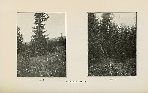
Engelmann spruce · Picea engelmannii
The dark spire of the cold, wet high country and the creek bottoms, often with subalpine fir at its side.
✓ Lewis & Clark NF
TreesSlopes around Neihartdominant
Lodgepole pine · Pinus contorta
The tall, straight, close-ranked pine that clothes most of the Little Belts — and the logs, cut on Kings Hill, that the 1941 school was built from.
✓ Lewis & Clark NF
TreesDraws & burn edgesgold in late September
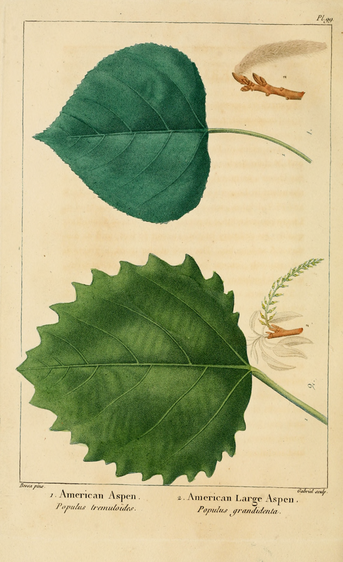
Quaking aspen · Populus tremuloides
White bark and coin-shaped leaves that shiver in the least wind and turn the draws gold in late September — the fall color of the Little Belts.
✓ Lewis & Clark NF
Mobility§ 04
Every way in, out and across the zip — the trains and where they're headed, the buses, the bike docks, a cab when you need one, and what to do with a car.
No mobility ledgered yet.
Under the block§ 05
The block from below and at the corner — the traffic signals that time the street, and the manholes, drains and subway mouths that open onto everything running beneath it. Counted from OpenStreetMap; the parts no city publishes are named, not guessed.
🚦 Traffic signals
No traffic signals ledgered yet — they come in from OpenStreetMap on the next sync.
⌾ Under the street
Nothing ledgered under the street yet — manholes, drains and subway access arrive on the next OpenStreetMap sync.
Eat & drink§ 06
Every café, restaurant, bar and counter on the ledger — typed and faceted straight from the knowledge layer.
Bars · RestaurantsMain Street (U.S. 89)
Bob's Bar
Bar & grill
The economy of 59465§ 07
The zip's flagships, staples and indies, the brands they carry, and the shared product vocabulary underneath — the graph an integrated zip-POS would settle against. 0 retailers · 0 brands tracked.
No retailers ledgered yet — run the seed.
Carriers on the ledger · brand graph synced from Notion
No ledgered carriers yet — run the sync.
Product-type master library · tap a group to shortlist brands
Who's here§ 08
The block's human makeup — the cohorts, the day-vs-night swell, the mix of who shows up. Set a lens up top and you'll see yourself among the neighbours.
43
residents
~120
here by day
55
median age
Live here vs. here for the day
Live here 36%Come in for the day 64%
About 77 more people are here by day than sleep here.
Source: U.S. Census 2020 — 43 residents (est. ~67 in 2024). Daytime figure rises with Showdown, forest recreation and highway traffic on Kings Hill; median age approximate — to verify.
Who governs§ 09
Every seat that holds power over the block, from the community board to the president. The template ships the seats; each edition fills the names from a dated source — an open seat means not yet sourced, never guessed.
0/15 seats sourced
On the block
Community Boardseat open · to be sourced
Business Improvement Districtseat open · to be sourced
City Council Memberseat open · to be sourced
The city
Mayorseat open · to be sourced
Public Advocateseat open · to be sourced
Comptrollerseat open · to be sourced
Borough Presidentseat open · to be sourced
District Attorneyseat open · to be sourced
The state
Governorseat open · to be sourced
State Senatorseat open · to be sourced
State Assembly Memberseat open · to be sourced
The nation
U.S. Representativeseat open · to be sourced
U.S. Senator (senior)seat open · to be sourced
U.S. Senator (junior)seat open · to be sourced
Presidentseat open · to be sourced
Under watch§ 10
The police surveillance technology documented over this block — plate readers, cameras, drones, face recognition and the rooms that pool them. Counted from the Atlas of Surveillance; a category with none documented is marked as such, never guessed, because absence of a record is not proof a tool isn't in use.
0 systems documented · 0/12 watch categories
FRFace recognitionnone documented
Software that matches faces from cameras or photos against a database to put a name to a person — often without their knowledge or consent.
none documented in Neihart
ALPRLicense plate readersnone documented
Cameras that photograph every passing plate and log where and when it was seen, building a searchable map of a car's movements over months or years.
none documented in Neihart
CSSCell-site simulatorsnone documented
“Stingray” devices that impersonate a cell tower so nearby phones connect to them, revealing the location and identity of every handset in range.
none documented in Neihart
PPPredictive policingnone documented
Algorithms that forecast where crime will happen or who is likely to be involved, directing patrols and scrutiny toward people and blocks by statistics.
none documented in Neihart
UASDronesnone documented
Unmanned aircraft used for aerial surveillance, crowd monitoring and, increasingly, as first responders dispatched to calls with cameras rolling.
none documented in Neihart
GSDGunshot detectionnone documented
Networks of always-on microphones on streetlights and buildings that listen for gunfire — and can capture voices — then send police to the sound.
none documented in Neihart
VAVideo analyticsnone documented
AI layered onto camera feeds to automatically flag people, objects or behaviour, and to search hours of footage for a shirt colour, a bag, a face.
none documented in Neihart
REGCamera registrynone documented
A roster of private security cameras — doorbells, shops, homes — that residents register or connect, letting police pull footage from across the block.
none documented in Neihart
BWCBody-worn camerasnone documented
Cameras worn by officers. A record of encounters that can protect the public — but also a mobile, searchable feed whose footage the department controls.
none documented in Neihart
TPIInvestigative data platformsnone documented
Commercial services that pool phone, location, social-media and public records into one search, letting police buy access to data they'd need a warrant to collect.
none documented in Neihart
RTCCReal-time crime centernone documented
A control room fusing live camera, plate, gunshot and phone feeds onto one wall — the hub that turns scattered sensors into continuous watching.
none documented in Neihart
FCFusion centernone documented
A state or regional office where local, state and federal agencies share intelligence — pooling records on people across jurisdictions with little public oversight.
none documented in Neihart
Sourced from Atlas of Surveillance · EFF & UNR Reynolds School of Journalism · atlasofsurveillance.org ↗
A record here means a documented deployment — its absence is not proof a technology isn't in use, only that it hasn't been sourced yet.
Yeah·borhood
Proof, not ads · 59465 pilot · 0 doors waiting for their next story